York Factory THEN & NOW
York Factory operated continuously between 1684 and 1957. Due to erosion and flooding along the north shoreline of the Hayes River the Factory was forced to relocate (within a short distance of each other) three times. The first location known as York Fort, was from 1684-1715. The second location known as York Factory was from 1715-1788. The third and current location of York Factory covers the period 1788-1957. Since closing in 1957 the Factory has been designated as a Federal Park administered by Parks Canada.
Unfortunately, the first two Fort/Factory sites have been lost to riverbank erosion. The first location is covered by the Hayes River itself. Now there is concern for saving the integrity of the current York Factory site as it continues to be threatened with riverbank erosion.
Unfortunately, the first two Fort/Factory sites have been lost to riverbank erosion. The first location is covered by the Hayes River itself. Now there is concern for saving the integrity of the current York Factory site as it continues to be threatened with riverbank erosion.
YORK FACTORY 1697 --- Library & Archives Canada, Ottawa. Image: C-113194 used with permission -- source: http://www.checkmatebook.com/uploads/2/1/6/1/21611804/c-113194lowresx.jpg
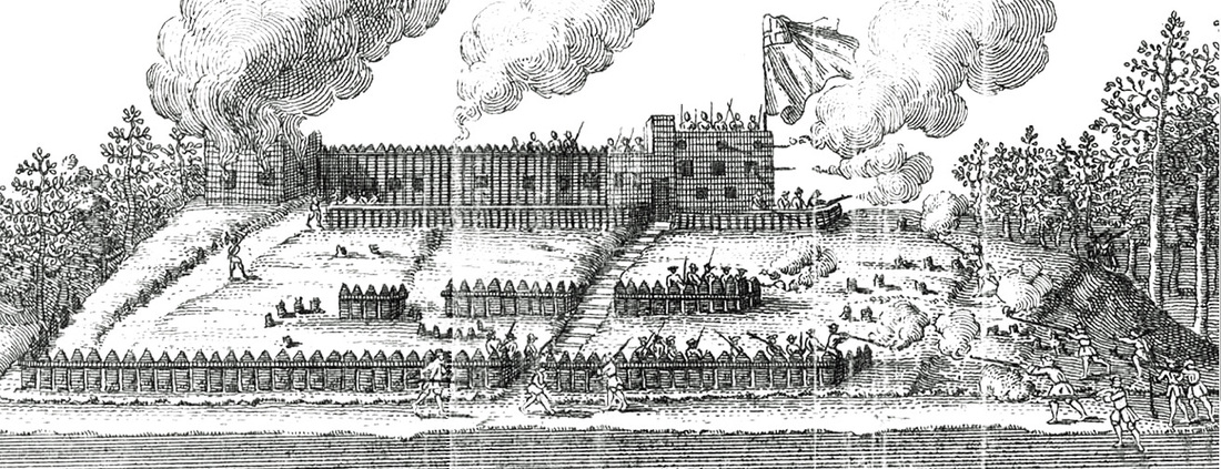
YORK FACTORY 1770's -- Samuel Hearne engraving coloured. Date: March 1, 1797.
Hudson's Bay Co. Archives, Provincial Archives of Manitoba / Engraver: Wise / HBCA P-228 (N8317)
Source: -- http://www.pc.gc.ca/lhn-nhs/mb/yorkfactory/natcul/histo.aspx
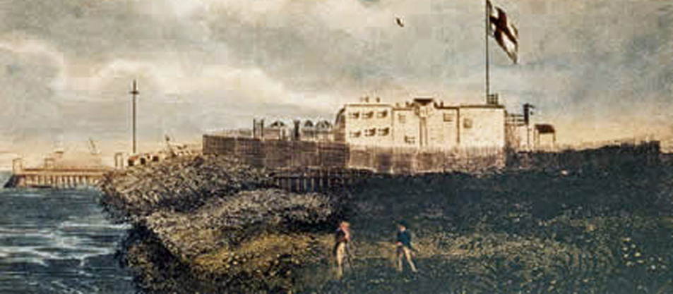
YORK FACTORY 1812 --
Painted by Peter Rindesbacher. Source: National Archives of Canada, Ottawa, -- Location: -- http://www.mhs.mb.ca/docs/mb_history/46/qualityoffriendship.shtml
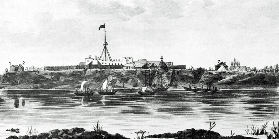
YORK FACTORY 1853 -- Coloured lithograph by W. Trask, National Archives of Canada/C-16826). -- Source: --
http://www.thecanadianencyclopedia.com/articles/york-factory
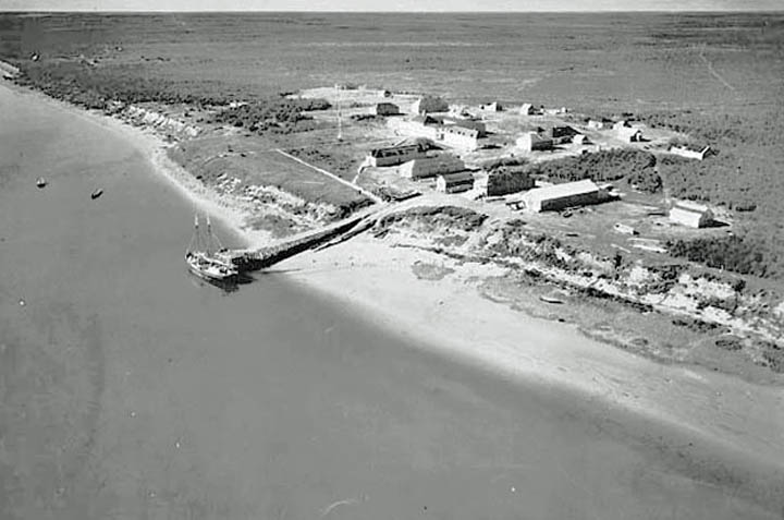
York Factory 1926 (click to increase image by using keyboard enlarging function) -- Library and Archives Canada / PA-041571 -- DAPDCAP172993 -- MIKAN no.3192800 (Image in Public Domain) --
Source:
http://upload.wikimedia.org/wikipedia/commons/6/66/YorkFactoryaerial.jpg
York Factory Is Slowly Eroding Away Into The Hayes River !
|
|
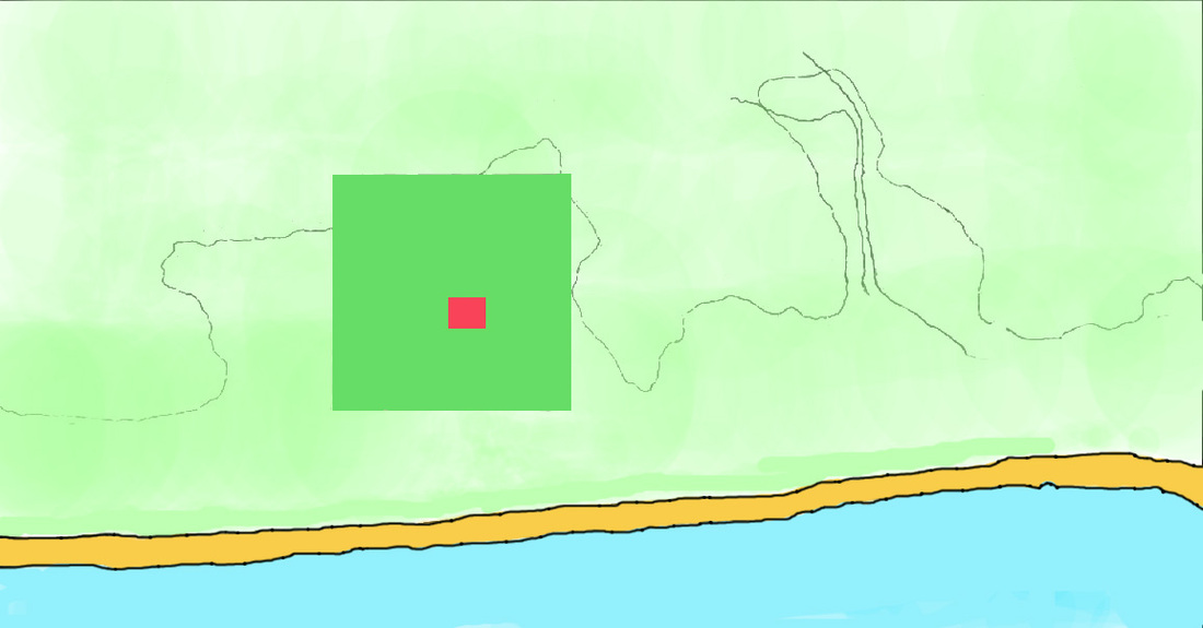
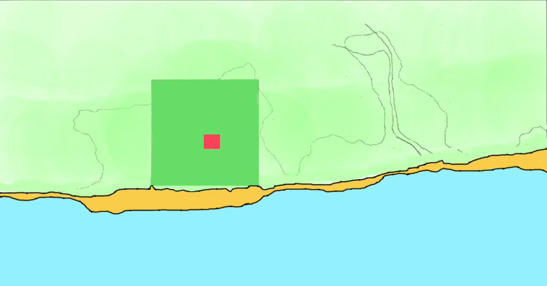
Left Map - York Factory 1900* Right Map - York Factory 1979*
[Blue = Hayes River; Orange = River Bank; Green = Depot Site; Red = York Factory Depot]
These two maps illustrate the dramatic effects of shoreline erosion at York Factory over a 79 year interval at a rate of almost 2 feet (0.6m) per year!** If not checked it is suggested that the present day York Factory Depot Site could be lost to erosion in 100 to 150 years.
CLICK HERE TO SEE PHOTOGRAPHIC EVIDENCE OF SHORELINE EROSION AT YORK FACTORY 1926 - 2005
*The 2 maps are based upon a photo by K. Skatfeld, and a diagram on p.9 of the 2007 Parks Canada, York Factory - National Historic Site of Canada Management Plan Source: -- http://www.pc.gc.ca/lhn-nhs/mb/yorkfactory/plan/pd-mp_e.pdf
**about 3m/5yrs aveg over 100 year period
THE 2010 VISIT
BY THE 39th GOVERNOR OF
THE HUDSON BAY COMPANY
TO YORK FACTORY
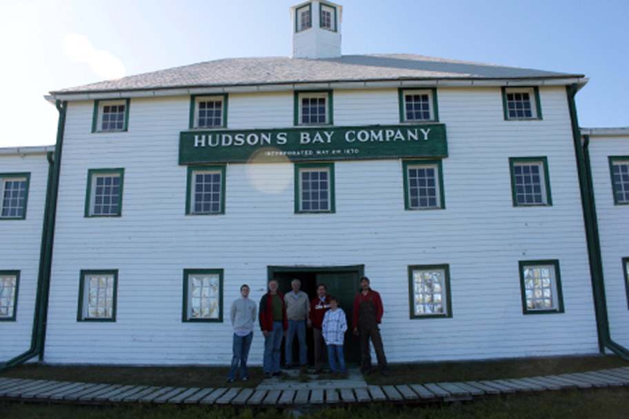
YORK FACTORY 2010 -- Richard Baker, the current Governor and CEO of the Hudson's Bay Company (HBC) undertook a 'CROSS CANADA TOUR' in the summer of 2010 of selected HBC establishments. A visit to York Factory was on his itinerary. This photo was taken by him as he arrived at the Factory via helicopter. --
Source: https://richardbtourscanada.wordpress.com/tag/the-york-factory/
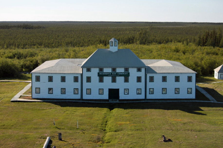
YORK FACTORY 2010 -- Click the image to watch a video clip of Cam Elliott, the Superintendent of Wapusk National Park of Canada & Manitoba North National Sites of Canada, explain the public store in the depot of the York Factory to Governor Baker who was the first Governor to visit York Factory since the middle of the 19th. century
FLYING TO YORK FACTORY IN
THE 21st CENTURY
2010 -- Click on the image to see HBC Governor Baker's helicopter approach to York Factory in 2010
|
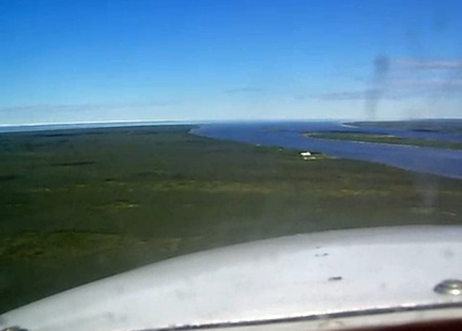
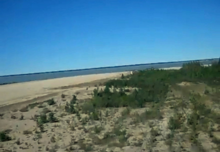
2008 -- Click on this image to see an approach to York Factory in a BN2 Islander aircraft. The landing air strip is on the island in the Hayes River across from the Factory. After passing over the air strip the general view eastward past the mouth of the Hayes River is where Le Pélican and Hampshire, Dering and the Royal Hudson's Bay engaged each other in the Battle of the Bay in 1697. The plane makes a 180deg. turn to the right for its final approach, and a very bumpy landing.
|